By Mike Carr
Photos by Dan Gurndert & Rick Levasseur
SnowGoer Magazine, October 2015
When we poured on the last burst of power and zoomed up to the summit of Maine’s Ragged Mountain, it felt like we were on top of the snowmobiling world – with a panoramic view to match. Spread before us was an endless expanse of lakes and forests, crisscrossed by scenic and well-groomed trails that stretch to the rugged horizon.
Dominating the view was Maine’s highest peak, towering Mount Katahdin (5,268 feet) – named by the Penobscot Indians as “The Greatest Mountain.” Even though a relentless wind threatened to toss us off the mountaintop, we were in no hurry to descend from this lofty perch. It’s a magical place.
Central Maine is one of those lucky locales that receives plenty of snow almost each season, no matter what’s happening in the rest of the North American Snowbelt. Last year, as the white stuff piled up across New Eng- land, the region around Millinocket and Mount Katahdin enjoyed some of the best conditions imaginable.
For a snow-starved Midwesterner like myself, visiting this area was the highlight of an otherwise disappointing season. I made the pilgrimage to this snowmobiling holy land in mid-March along with avid rider, photographer and blogger Dan Guendert, who was experiencing Maine for the first time.
Get Ready To Ride
Our hosts were Rick and Debbie LeVasseur, owners of the 5 Lakes Lodge, a deluxe resort on South Twin Lake, one of the arms of Pemadumcook Lake. This large body of water lies 5 miles west of the town of Millinocket and approximately 25 miles south of Mount Katahdin. The lodge – situated on a small peninsula with water views on three sides – is a first-class bed and breakfast featuring five well-appointed rooms and sumptuous morning meals prepared by Debbie. On the evening of our arrival, the LeVasseurs took us out for a wonderful dinner at the Scootic Inn, one of the oldest restaurants in Millinocket.
Our first day of riding began after a hearty breakfast featuring Debbie’s tasty walnut and blueberry pancakes. Thus fortified, we set off northeast in a steady snowfall, soon crossing the beautiful Wiley suspension bridge over the west branch of the Penobscot River, where the dark, rushing water roiled below us. The two branches of this beautiful waterway – used for more than half a century as a conveyor of huge, cut logs to lumber and paper mills downstream – are encountered numerous times by snowmobilers exploring the area.
Dan and I were aboard a pair of Ski-Doo rental sleds provided by New England Outdoor Center, a year-round recreation hub that caters to enthusiasts of all kinds. The facility, north of Millinocket, includes the River Driver’s restaurant, making it a popular pit stop for sledders. It’s also home to the Twin Pines Snowmobile Club.
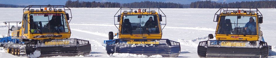
Rick was our leader for three days of riding, with Debbie and his brother Mike accompanying us on some of our outings. Rick is the energetic, “can do” president of the Jo Mary Riders, the lo- cal club that takes its name from nearby Jo Mary Mountain Wilderness Area. In that capacity, he coordinates the comprehensive grooming activity that keeps the trails in magic carpet condition, with three full-size Bombardier tractors and drags based out of 5 Lakes Lodge.
After passing through the edge of historic Millinocket – founded as a mill town in 1901 – we turned north on Interconnected Trail System trail 85/86, which would be our route most of the way to Shin Pond, our lunch destination. Many of the miles were over gently rolling terrain on unplowed but smoothly groomed forest roads with broad, sweeping turns.
This trail took us east of Baxter State Park and Mount Katahdin, carrying us over the east branch of the Penobscot River at Whetstone Falls and across the Seboeis River on the Phillpott Bridge. Both of these spans were more than 100 feet long, affording us a view of water tumbling over the rocky rapids below.
During a trail stop, Rick explained that the area where we were traveling is under consideration as a potential National Park, something that has stirred strong feelings among local residents. If snowmobile trails are part of the plan and access is assured, Rick believes that the increased tourism year-round will be beneficial to the region.
After lunch at the Shin Pond Village Restaurant, we backtracked halfway, and then took the Katahdin Loop Trail (KLT) south to the town of Medway. After passing the East Branch Snow Rovers club house, the trail took us by a dam and hydroelectric power plant, giving us a view from the bluff above.
Our route led us over the Nicatou Bridge, a large highway span that takes its name from the Penobscot word meaning “where the waters meet.” We stopped on the bridge, looking upstream to admire the water cascading over the dam and downstream to see the confluence of the river’s two branches. It was an impressive view, despite being partially obscured by the falling snow.
The intensity of the precipitation increased as we veered off the KLT for the last leg home, necessitating constant glove wipes of our faceshields. We arrived back at the lodge with
124 miles logged for the day – all of it on smooth, well-groomed trails. We capped off our evening with a delicious dinner in Millinocket at the Pelletier Loggers Bar&Grill.
Fresh Snow&Groomed Trails
That day’s escalating snowfall was the leading edge of a blizzard that buffeted the lodge all night with its spirited winds. The snow quit by mid-morning and after Rick spent some time plowing (while Dan and I enjoyed another of Debbie’s tasty breakfasts), we suited up for our ride.
With the late start, Rick decided to show us the nearby trails and sights, starting with the aforementioned climb to the top of Ragged Mountain, where a tall metal framework was the only remnant of a former fire tower. That was followed by a tour of trail segments, loops and connecting routes maintained by the Jo Mary Riders, including a climb to another scenic lookout on Greenwood Mountain, where we could fully appreciate the job of the club members.
“We groom over 100 miles of trail,” Rick said. “In addition to state grants that cover a portion of our expenses, we rely heavily upon our members – many of them from southern Maine or out of state – to finance our efforts. Providing high quality trails is our goal and we take pride in what we do.
“During high traffic times, we groom five or six nights per week,” he said. “By grooming frequently and at night our trails can withstand a lot of use and hold up well.”
As avid riders, Dan and I know what a superb trail network looks and feels like – and we were both impressed. We also saw the trio of groomers go out at sunset each night, even though it was midweek, and in mid-March. These guys take grooming seriously, folks! As testimony to that, groomer operator Dave Silvia was named the Maine Snowmobile Association’s Groomer of the Year as the season concluded – an honor Rick also received in 2007.
Heading north, we crossed the northwest end of Pemadumcook Lake and set course for Abol Bridge, where adjacent road and snowmobile bridges span the Penobscot River’s west branch. We enjoyed a hearty lunch there at The Northern Restaurant, where we met a solo Canadian rider who said he had departed Quebec early that morning and had already covered more than 400 kilometers (250 miles) – and it was only mid-day. His odyssey proved not only his intrepid nature, but also the quality of the trail network throughout north- western Maine.
After savoring a delicious bowl of chunky New England clam chowder, it was time to hit the trail again for the homeward journey back to the 5 Lakes Lodge. Our route took us past Millinocket Lake and featured several sections of roller coaster riding along a series of power lines as we cruised through a mixed forest of hardwood and conifers. On the way, we visited the New England Outdoor Center, where we made a dinner reservation for later that evening. We returned to the lodge at sundown after a circuitous, 94-mile excursion.
More Beauty
The destination on our final day was the Chesuncook Lake House, a structure built in 1864 at the northern end of the 20-mile long lake of the same name. It was a glorious, sunny day and again the trails were groomed to perfection.
Along the way, we stopped at the site of Grant Farm, a long-abandoned crop and cattle operation that supplied food for decades to loggers of the Great Northern Paper Company. According to Rick, these farms were established approximately 14 miles apart, the optimal distance given the limitations of transport in the late 19th century. Now all that remained were a large open field, the barn foundation and several stone pillars that overlooked this now-tranquil but once-bustling place.
Arriving at Chesuncook Lake, we found the trail – a 16-foot wide ribbon amid a vast expanse of snow-covered ice – to be well marked and smooth, making our 17-mile cruise up the lake a pleasure instead of an ordeal. Along the way, we overtook the Chesuncook groomer and stopped to take some photos with majestic Mount Katahdin as the distant backdrop. Its 5,268-foot altitude is exaggerated by surrounding lowlands that make it really stand out.
When we reached the Lake House for lunch and refueling, there were at least a dozen other snowmobiles parked outside. “Even though it’s on the edge of the trail network, this is a popular destination,” Rick said. “It’s also the staging point for snowmobilers who want to follow a secondary trail to ‘the trains,’ two steam locomotives that were abandoned in the woods about 25 miles from here.”
Those who make that journey earn the right to display an “I made it to the trains” sticker on their sleds. Our time was limited on this day, so we left that experience for another time.
On the return trip south, Rick veered off the beaten path and took us down another arm of Caribou Lake. As we bounded over small drifts and looked left and right, we saw shoreline ice shelves and a far-off patch of open water glistening in the afternoon sun. Before long,
we were ashore and winding our way along what Rick dubbed a “goat path,” an untracked shortcut through the for est. After pushing powder and dodging overhanging branches for half a mile, we emerged onto a groomed connector trail that hooked into the KLT.
Just before reaching home, Rick took us to an elevated clearcut area, where we enjoyed a panoramic view northward that included dozens of lakes and distant Mount Katahdin on the horizon. Below us was the vast expanse of forestland that we had enjoyed thanks to the generosity of the timber companies who own most of that land.
“There are four major landowners in this region,” Rick explained, “and with- out their permission and cooperation, we wouldn’t have these great riding opportunities. Huber Resources owns a lot of acreage around Shin Pond and that area is honeycombed with trails. As president of the Jo Mary Riders, I deal with the other three companies – Katahdin Forest Management, Prentiss & Carlisle and Wagner Forest Management. I’ve been very fortunate over the years to develop a wonderful working relationship with the land managers and foresters of all three companies. As a club, we never do anything without asking permission first and whenever they ask us to do something we get it done as quickly as possible. Our respect for their land has allowed all area clubs to have and maintain hundreds of miles of trails in the Katahdin region and beyond.”
And what land it is: scenic, mountainous, densely wooded and rural yet inviting. Maine may not be easy to reach, but its allure is magnetic.
Download a pdf file of the SnowGoer October 2015 article with photos.